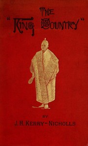
The King Country; or, Explorations in New Zealand A Narrative of 600 Miles of Travel Through Maoriland. — Edition Insights

(3 User reviews)   692
In Category - Exploration
Kerry-Nicholls, J. H. (James Henry), -1888 Project Gutenberg 2016 Not confirmed
New Zealand -- Description and travel Readers of public-domain and historical texts
Project Gutenberg digital edition en

Edition facts

Words 103,114
Reading time 449 min
Text sections 14

For The King Country; or, Explorations in New Zealand A Narrative of 600 Miles of Travel Through Maoriland. — Edition Insights, the stored edition analysis reports 103,114 words, 7 hr 29 min estimated reading time, and 14 detected text sections.

The text analysis averages about 28.6 words per sentence, while the detected sections provide another way to judge how the source is divided.

Project Gutenberg metadata also associates the work with “New Zealand -- Description and travel,” connecting these edition facts with the source record’s subject description.

An editorial note examining J.H. Kerry-Nicholls's authorial choices in diction, dialogue, and description within his 1884 narrative of 600 miles through the Maori-controlled King Country, based on the preface and a crater description excerpt.
Share
Editorial Edition Score 4.9/5

Calculated from edition completeness, EPUB availability, text structure and catalogue metadata. Not a user rating.

How this score is calculated
  • Description quality20 pts
  • Title & short description10 pts
  • Source metadata20 pts
  • Text length15 pts
  • Chapters / structure15 pts
  • EPUB file integrity20 pts

Total of 100 points, scaled to a 2.5-5.0 range. Editions with an empty description or a missing EPUB file are not scored.

Edition quality

Read the Text

Alexandra--Crossing the frontier--Whatiwhatihoe--The camp--King Tawhiao--The chiefs--"_Taihoa_" 17

The Kingites--Half-castes--An albino--The king's speech--Maori oratory--The feast 27

Mount Pirongia--Geological features--The ascent--A fair prospect 36

AUCKLAND TO OHINEMUTU.

The flank movement--Auckland Harbour--Tauranga--Whakari--The _tuatara_--_En route_--The Gate Pa--All that remains--Oropi--A grand forest--Mangorewa Gorge--Mangorewa River--A region of eternal fire 46

Ohinemutu and Lake Rotorua--Te Ruapeka--The old _pa_--Native baths--Delightful bathing--A curious graveyard--Pigs--Area of thermal action--Character of the springs--Chemical constituents--Noted springs--Whakarewarewa--Te Koutu--Kahotawa--"_Tenakoe, pakeha_"--Hot and cold 56

TRADITION, IDOLATRY, AND ROMANCE.

Origin of the Maoris--Te Kupe--First canoes--The _runanga_ house--Maori carving--Renowned ancestors--Tama te Kapua--Stratagem of the stilts--Legend of the whale--The Arawa canoe--Noted braves--Mokia--A curious relic--Gods of the Arawas--Mokia by night--Hinemoa--A love song 68

EN ROUTE TO THE TERRACES.

Over the mountains--Rauporoa Forest--The _hotete_--Tikitapu--Rotokakahi --Te Wairoa--The natives--Waituwhera Gorge--The boat--A distinguished traveller--Sophia--Lake Tarawera--Mount Tarawera--Te Ariki--Te Kaiwaka 81

Te Tarata--Beauty of the terrace--The formation--The crater--A sensational bath--Ngahapu--Waikanapanapa--A weird gorge--Te Aua Taipo--Kakariki--Te Whatapohu--Te Huka--Te Takapo--Lake Rotomahana--Te Whakataratara--Te Otukapurangi--The formation--The cauldron 94

OHINEMUTU TO WAIRAKEI.

Te Hemo Gorge--Mount Horohoro--Paeroa Mountains--Orakeikorako--Atea -Amuri--Pohaturoa--The land of pumice--Te Motupuke--The glades of Wairakei 109

The first view--The Geyser Valley--Curious sights--Tahuatahe --Terekirike--The Whistling Geyser--A nest of stone--Singular mud-holes--The Gas and Black Geyser--The Big Geyser--The great Wairakei--The Blue Lake--Hot mud-holes--Kiriohinekai--A valley of fumaroles--Te Karapiti Te Huka Falls--Efforts to pass under the falls--A cave--An enormous fissure--Another trial--A legend 115

EXPLORATION OF THE KING COUNTRY.

Reason of the journey--How I succeeded--My interpreter--Our horses--The Hursthouse difficulty--Departure from Wairakei--Tapuwaeharuru--The natives--Release of Hursthouse, and capture of Te Mahuki--The council of war 131

THE REGION OF LAKE TAUPO.

Natural phenomena--The great table-land--Position and dimensions of the lake--Water-shed--Geological features--The lake an extinct crater--Crater lakes--Areas of thermal action 139

EASTERN SHORE OF LAKE TAUPO.

A grand view--True source of the Waikato--The river of "streaming water"--Our first camp--Variation of temperature--Roto Ngaio--Te Hatepe--Te Poroporo--The lake beneath us--A canoe--Motutere--Tauranga--Southern shore of the lake--Delta of the Upper Waikato 149

Scenery--The springs--The natives--Old war-tracks--Te Heuheu--A Maori lament--Motutaiko--Horomatangi 161

THE RANGIPO TABLE LAND.

Along the delta of the Upper Waikato--Mount Pihanga--The Poutu River and Lake Rotoaira--Boundaries of the Rangipo--Scenery--A fine night--A rough time--A great storm--The _karamu_ as fodder--Banks of the Upper Waikato--Another start--More bad weather--Flooded creeks--Pangarara--Te Hau 168

Physical and geological features--Legend of Tongariro--A break in the clouds--The start for the ascent--Maories in the distance--The Waihohonu valley--The ascent--The brink of Hades--The great crater--The inner crater--The lower cones--Crater lakes--The descent--A valley of death--Tongariro by moonlight--A cold night--The start for Ruapehu 179

Approaching the mountain--A field for research--Physical and geological features--Plan of attack--Curious icicles--A lava barrier--Natives in the distance--Horse camp--Scoria hills and lava ridges--The start for the snow-line--Up the great spur--Head of the spur--Our camp--A wind-storm--Ruapehu by night--A picture of the past--Waiting for sunrise--Sunrise 199

ASCENT OF THE GREAT PEAK.

The start--A lava bluff--Last signs of vegetation--Wall of conglomerate rock--The Giant Rocks--Ancient crater--Difficult climbing--A frightful precipice--The ice crown--Cutting our way over the ice--The summit--Peaks and crater--A grand _coup d'oeil_--The surrounding country--Taking landmarks--Point Victoria 217

THE KAIMANAWA MOUNTAINS.

Further plans--Across the plains--_In memoriam_--The Onetapu Desert--Mamanui camp--Grilled _weka_--A heavy frost--The Kaimanawas--Geological formation--A probable _El Dorado_--Reputed existence of gold 229

SECOND ASCENT OF RUAPEHU. SOURCES OF THE WHANGAEHU AND WAIKATO RIVERS.

Curious parterres--Supposed source of Whangaehu---A gigantic lava bed--A steep bluff--The Horseshoe Fall--The Bridal Veil Fall--The Twin Falls--A dreary region--Ice caves--Source of the Waikato--The descent--Our camp on the desert 237

Our commissariat gives out--The Murimotu Plains--The settlement--The homestead--The welcome--Society at Karioi--The natives--The Napier mail 252

The start from Karioi--On the track--Te Wheu maps the country--The primeval solitude--Terangakaika Forest--The _flora_--Difficulties of travel--The lakes--Birds--Pakihi--Mangawhero River--Gigantic vines--Fallen trees--Dead forest giants--Mangatotara and Mangatuku Rivers--A "Slough of Despond"--Dismal swamp 258

The _wharangi_ plant--Enormous ravines--Ruakaka--Reception by the Hauhaus--The chief Pareoterangi--The parley--Hinepareoterangi--A repast--Rapid fall of country--The Manganui-a-te-Ao--Shooting the rapids--The natives--Religion--Hauhauism--Te Kooti's lament--A Hauhau hymn 269

Departure from Ruakaka--A legend--Rough forest--Crossing the Manganui-a-te-Ao--Scenery of the river--Mount Towai--The plains in sight--Rapid rise in the country--Ruapehu from the west--The Waimarino plains--Arrival at the _pa_--The chief's family--A Hauhau chief--_Inter alia_--Pehi on the decay of the Maoris--A war-dance--The mere 281

HOT SPRINGS OF TONGARIRO.

Departure from Ngatokorua--Okahakura Plains--Tongariro from the north--Source of the Whanganui--The hot springs--A marvellous sanatorium--Crater of Ketetahi--Te Perore--A strategic position--Kuwharua--Maori cakes--A grand region--Site for a public park 295

Supposed forest country--The western table-land--Soil and _flora_--Terania--Okarewa--Te Kaina Valley--Maoris on the track--Pouotepiki _pa_--A tangi--The natives--A friendly invitation--An old warrior--The women--Our quarters 304

THE NORTHERN TABLE-LAND.

The Whanganui stream--Oruapuraho Valley--Waihaha River--Kahakaharoa--The sweetbriar--The kiwi--The moa--A gigantic lizard--Waikomiko and Waihora Rivers--Te Tihoi Plains--Scenery--Mount Titiraupenga--Mangakowiriwiri River--Mangakino River--Swimming horses--Our camp--The Maoris as travellers--A Maori joke--Good horsemen--Their knowledge of the country--Their endurance--The Waipapa--Te Toto Ranges--The Waipari--Te Tauranga--The Upper Puniu--A fine specimen of tattooing--A night at Hengia 315

Manga-o-rongo--Mangatutu River--The encampment--A sumptuous repast--The _kainga_--Surrounding scenery--Old warriors--The tribes--The Korero--Arrival of Te Kooti--His wife--His followers--A _tête-à-tête_--A song of welcome--A _haka_--Departure from Manga-o-rongo--Waipa River--Valley of the Waipa--Our last difficulty 328

Potatau II. 345 Major Te Wheoro, M.H.R. 348 List of the New Zealand Tribes, with their localities 351 The Flora 352 The Fauna 360 The Maori language 366

LIST OF ILLUSTRATIONS.

King Tawhiao _Frontispiece_ The Maori Queen, Pare Hauraki 21 Wahanui, chief of the Ngatimaniapoto tribe 24 Manga Rewi, a chief of the Ngatimaniapoto tribe 25 Major Te Wheoro, M.H.R. 28 Te Tuhi, a chief of the Waikato tribe 29 Albino woman 30 Whitiora Wirouiru te Komete, a chief of the Waikato tribe 32 Paora tu Haere, head chief of the Ngatiwhatua tribe 34 Hati Wira Takahi, chief of the Ngapuhi tribe 37 Tawhao Ngatuere, a chief of the Ngatikahunu tribe 38 A chief of the Ngatiproa tribe 39 Paratene te Manu, a chief of the Ngatiwai tribe 40 Tukukino, head chief of the Ngatitematera 42 Te Raia Ngakutu te Tumuhuia, head chief of the Ngatitematera tribe. Last of the New Zealand Cannibals 43 Whakari, or White Island 48 The Tuatara 49 Native woman and child, Ohinemutu 58 Native village (_Lake Rotoiti_) (_Page_) 62 Specimen of Maori carving 72 Native woman, Lake Country 86 Pohaturoa 113 Section of valley of Waikato River at Huka Falls 126 Transverse section of North Island from S.W. to N.E. 140 Terrace formation and hot springs (_Valley of the Waikato_) 146 Lake Taupo (_Page_) 150 Source of the Waikato at Lake Taupo 153 Tongariro (_Page_) 180 Tongariro by moonlight (_Page_) 197 Mount Ruapehu (_Page_) 200 Summit of Ruapehu 204 Waiting for sunrise 213 Wall of lava conglomerate 219 The ice crown, Point Victoria 227 Great trachytic lava bed 240 The Bridal Veil Fall 245 Ruakaka (_Page_) 272 A chief armed with "mere" and "huata" 293 A "mere" 294 Native girl 312 Moa and apteryx 317 Native girl 330 Woman of the Waikato tribe 333 Te Kooti, from a sketch by the author 335 Te Kooti's wife 336

Geographical description of the King Country--Its political state--Efforts made to open it--Condition of the natives--Origin of the journey--Letter of introduction to the king.

That portion of the North Island of New Zealand known as the King Country extends (as near as the boundary can be defined) from lat. 38° to 39° 20' S., and from long. 174° 20' to 176° E. Its approximate area is equivalent to 10,000 square miles. In the north the _aukati_, or boundary-line--separating it from the European portion of the colony--passes by the southern shores of Aotea Harbour, thence easterly through the Pirongia Ranges in a direct line to the Waikato River, along which it follows nearly to Atea-amuri, from which point it strikes directly south to Lake Taupo. It takes in the whole of the western half of that lake; it then stretches south along the Kaimanawa Mountains to the Murimotu Plains, whence it goes westerly, round the southern base of Mount Ruapehu to the mouth of the Manganui-a-te-Ao River, and thence north-westerly until it joins the coast at a point a little to the north of Pukearuhe.

The physical features of this vast region present not only many beauties, but many natural advantages for European settlement, while it is one of the best watered parts of the island. In its southern portion the Whanganui River passes through it in a long winding course to the sea, fed by many tributaries flowing from the high mountain-ranges, both in the south and central divisions of the island. In the west the Mokau River and its affluents flow from its central region to the coast. In the north the Waipa Puniu and various other streams, having their sources in the Titiraupenga and Rangitoto Mountains, wind through it to the Waikato River; the high, wooded ranges of the central table-land form the sources of many watercourses disemboguing into Lake Taupo; while in the south-east the snow-clad heights of Tongariro and Ruapehu pour down their rapid waters in a perfect network of creeks and rivers. In the west it has a coast-line of over sixty miles, and it possesses one of the largest harbours in the island. Extensive forests cover a large portion of its southern area, and extend northerly over the broken ranges of the Tuhua to Mount Titiraupenga and the Rangitoto Mountains. Westward of this division there is a considerable area of open country, including the valley of the Waipa, which in its turn is bounded in the west by high, fern-clad hills and wooded ranges. In the vicinity of the high, snow-clad mountains in the south, there are vast open table-lands; while immediately to the west of Lake Taupo and north of Titiraupenga to the banks of the Waikato, there are again extensive open plains.

Geologically considered, the King Country possesses in extensive depositions all the strata or rock-formations in which both gold, coal, iron, and other minerals are found to exist, while its extensive forests are rich in timber of the most varied and valuable kind. Geysers and thermal springs possessing wonderful medicinal properties are found in the vicinity of its many extinct craters; and, while it possesses one of the largest active volcanoes in the world, its grand natural features are crowned by the snowy peaks of some of the highest mountains of Australasia. In the north the trachytic cones of Titiraupenga and Pirongia rise to an elevation varying from 3000 to 4000 feet, near to its south-western boundary the snowy peak of Taranaki, or Mount Egmont, attains to an altitude of 8700 feet, on its eastern confines the rugged crater of Tongariro sends forth its clouds of steam from a height exceeding 7000 feet, while on its southern side the colossal form of Mount Ruapehu rears its glacier-crowned summit to an altitude of over 9000 feet above the level of the sea.[1] With these important features nature has endowed it with scenery of the grandest order, and with a climate unsurpassed for its variety and healthfulness.

The political state of the King Country forms one of the most interesting chapters in the history of New Zealand. In the early days, before the colony was founded in 1840, and long after that event, there were no such obstacles to travelling through the island as existed in later times. The Maoris rather welcomed Europeans, who were free to go anywhere, except on places which were _tapu_,[2] or sacred in their eyes, and in consequence what little has been hitherto known of the King Country has been derived from the experiences of one or two travellers who penetrated into portions of it some thirty years ago. Among the most active of the early travellers was Ferdinand Von Hochstetter, a member of the Austrian Novara Expedition, who, in 1859, at the instance of Sir George Grey, at that time Governor of the Cape of Good Hope, made a tour through a portion of the North Island in company with Drummond Hay, Koch, Bruno, Hamel, and a number of European attendants and natives. At this time the Maoris were ready to welcome Europeans; hostilities between the two races had never broken out, and Hochstetter and his party were received and _fêted_ everywhere with almost regal honours. But in the course of years, as it was evident to the natives that the Europeans were the coming power in the land, suspicion and distrust were excited, and at last the tocsin sounded.

The native chiefs, seeing that their influence was declining, and that in proportion to the alienation of the land, their _mana_ or authority over the tribes decreased, began to bestir themselves in earnest. It was considered that a head was needed to initiate a form of Government among the tribes to resist the encroachments daily made by the Europeans, and which seemed to threaten the national extinction of the native race.

The first to endeavour to bring about a new order of things was a native chief named Matene Te Whiwi, of Otaki. In 1853 he marched to Taupo and Rotorua, accompanied by a number of followers, to obtain the consent of the different tribes to the election of a king over the central parts of the island, which were still exclusively Maori territory, and to organize a form of government to protect the interests of the native race. Matene, however, met with but little success. Te Heuheu, of Taupo, the great chief of the Ngatituwharetoa, at that time the most warlike tribe in the island, had no idea of any one being higher than himself, and therefore refused to have anything to do with the new movement, nor did Te Whiwi meet with much greater encouragement at Maketu and Rotorua. The agitation, however, did not stop, the fire once kindled rapidly spread, ardent followers of the new idea sprang up, and their numbers soon increased, until finally, in 1854, a tribal gathering was convened at Manawapou, in the country of the Ngatiruanui tribe. Here a large _runanga_, or council-house, was erected, which was called _Tai poro he nui_, or the finishing of the matter, and after many points had been discussed, a resolution was come to among the assembled tribes that no more land should be sold to Europeans. A solemn league was entered into by all present for the preservation of the native territory, and a tomahawk was passed round as a pledge that all would agree to put the individual to death who should break it. In 1854 another bold stand was made, and Te Heuheu, who exercised a powerful sway over the tribes of the interior, summoned a native council at Taupo, when the King movement began in earnest. It was there decided that the sacred mountain of Tongariro should be the centre of a district in which no land was to be sold to the government, and that the districts of Hauraki, Waikato, Kawhia, Mokau, Taranaki, Whanganui, Rangitikei, and Titiokura should form the outlying portions of the boundary; that no roads should be made by the Europeans within the area, and that a king should be elected to reign over the Maoris.

In 1857 Kingite meetings were held at Paetai, in Waikato, and at Ihumatao and Manukau, at which it was agreed that Potatau Te Wherowhero, the most powerful chief of Waikato, should be elected king, under the title of Potatau the First, and finally, in June, 1858, his flag was formally hoisted at Ngaruawahia. Potatau, who was far advanced in life when raised to this high office, soon departed from the scene, and was succeeded by his son Matutaera Te Wherowhero, under the title of Potatau the Second.

The events of the New Zealand war need not here be recited, but it may be easily imagined that during the continuance of the fighting the extensive area of country ruled over by the Maori monarch was kept clear of Europeans. But in 1863 and 1864 General Cameron, at the head of about 20,000 troops, composed of Imperial and Colonial forces, invaded the Waikato district, and drove the natives southward and westward, till his advanced corps were at Alexandra and Cambridge. Then followed the Waikato confiscation of Maori lands and the military settlements. The King territory was further broken into by the confiscations at Taranaki and the East Coast, but no advance was, however, made, by war or confiscation, into the country which formed the subject of my explorations. The active volcano of Tongariro is _tapu_, or strictly sacred, in the eyes of the Maoris, and several persons who had attempted to ascend it were plundered by the natives, and sent back across the frontier. On the west of Taupo Lake lies the Tuhua country, whose people had from the first, from the nature of the district, been much secluded from European intercourse, and who besides had given refuge to many of the desperadoes of the other tribes; while to the south-west of Taupo Lake were the people of the Upper Whanganui country, who have always been suspicious and hostile, while for some considerable time, too, the whole district was in terror of Te Kooti and his marauding bands. It is from these causes that the vast and important area embraced by the King Country has remained closed to Europeans, and, all things considered, it is a fact which must ever remain one of the most singular anomalies of British colonization, that, after a nominal sovereignty of forty years over New Zealand, this portion of the colony should have remained a _terra incognita_ up to the present day, by reason of the hostility and isolation of the native race.

Having pointed out the leading causes which resulted in the closing of the King Country to European settlement, it will be interesting to glance at the endeavours which have been made by the different governments to break down the barrier of native isolation, and thus to throw open to the colonists an extensive area of the island, which is, in reality, as much a portion of British territory as is the principality of Wales. As is well known, since the termination of the lamentable war between the two races, the King natives have, on all occasions, jealously preserved their hostile spirit to Europeans; while the peculiar state of matters involved in the whole question, while unexampled in the history of any other part of the British Empire, has been naturally a source of annoyance and even danger to the several governments of the colony who have attempted from time to time to grapple with the native difficulty.

The New Zealand war concluded, or rather died out, in 1865, when the confiscated line was drawn, the military settlements formed, and the King natives isolated themselves from the Europeans. For ten years it may be said that no attempt was made to negotiate with them. They were not in a humour to be dealt with. About 1874 and 1875, however, it became evident that something would have to be done. The colony had greatly advanced in population, and a system of public works had been inaugurated, which made it intolerable that large centres of population should be cut off from each other by vast spaces of country which Europeans were not allowed even to traverse. From time to time during the whole period the awkward position of affairs had been forced on public attention by outrages and breaches of the law occurring on the border, the perpetrators of which took secure refuge by fleeing to the protection of Tawhiao, who then--as now--defied the Queen's authority within his dominions.

Sir Donald McLean, while Native Minister, had several important interviews with the Kingites, with a view to bring about a better relationship between the two races, and as he was well known to the natives both before and during his term of office, his efforts had considerable effect in promoting a more friendly intercourse.

Again, Sir George Grey, when Premier of the Colony, attended two large native meetings in the King Country, in 1878, and opened up communication with the chiefs of the Kingites. At the second meeting at Hikurangi about seventeen miles beyond Alexandra, Sir George Grey laid before the natives definite terms of accommodation. He offered to give back to them the whole of the land on the west bank of the Waipa and Waikato rivers, and to confer certain honours on Tawhiao, the son of Te Wherowhero, who had succeeded to the kingship. At a subsequent meeting held at Te Kopua, in April, 1879, these offers were again made, but Tawhiao, for some reason which has never been satisfactorily explained, declined to accept them, and they were distinctly withdrawn.

J.H. Kerry-Nicholls opens his narrative with a preface that foregrounds the logistical and political constraints of his journey: traveling with only an interpreter and three horses, carrying scant provisions, and crossing a territory closed to Europeans by Maori hostility. This framing establishes a tone of measured self-accounting rather than heroic boasting. The author’s diction in the preface—phrases such as “deep-rooted jealousy of the native race” and “unfavourable conditions”—reveals a colonial perspective that simultaneously acknowledges Maori agency and presents European exploration as a natural right. The excerpt from the crater description, by contrast, shifts into a scientific register, with precise geological terms like “trachytic rock,” “solfatara,” and “igneous action,” suggesting Kerry-Nicholls’s dual role as explorer and amateur naturalist.

The Author’s Self-Positioning in the Preface

Kerry-Nicholls’s preface is a deliberate act of self-positioning. He lists his achievements—discovering rivers, tracing river sources, ascending a high mountain—in a single, breathless sentence that emphasizes quantity over drama. The phrase “considerably over 600 miles of travel” is typical of his understated quantification; he lets the numbers speak. More telling is his description of the journey as “exciting by reason of the difficulties,” where “exciting” carries a Victorian sense of worthy ordeal. He also notes that the King Country had been “rigorously closed to Europeans by the hostility of the native tribes,” a phrasing that attributes closure to Maori action rather than European policy. This choice reflects a colonial narrative that casts Maori as obstacles, yet it also implicitly concedes their power to control access.

Geological Description as Sublime Spectacle

The crater passage demonstrates Kerry-Nicholls’s tendency to blend empirical observation with Romantic sublimity. He notes that the crater walls are “built up principally of enormous masses of trachytic rock, lava ridges, and beds of conglomerate,” a sentence that piles geological terms to convey scale. Yet he also describes the steam’s noise as “like the wailings of the condemned,” a simile that injects Gothic horror into the scientific account. The phrase “seething, fused mass of almost molten matter” hovers between accurate description and dramatic hyperbole. His eye for color is precise: sulphur deposits “lined its sloping sides with a bright-yellow coating, which came up to the very summit of its rim and looked like a circle of gold.” This visual detail, framed by the sun’s “prismatic hues,” transforms the crater into a jewel-like spectacle, revealing the author’s impulse to aestheticize the landscape even as he catalogs its geology.

Dialogue and the Absence of Maori Voices

Based on the excerpts provided, Kerry-Nicholls’s narrative includes little direct dialogue from Maori interlocutors. The preface mentions presenting credentials from Sir George Grey at a tribal gathering, but the excerpt does not reproduce any spoken exchange. This absence is itself a notable authorial choice: the explorer’s voice dominates, while Maori perspectives are filtered through his observations. When he refers to “the deep-rooted jealousy of the native race,” he attributes a collective emotion without quoting individuals. The narrative thus constructs Maori as a silent, monolithic presence, their agency acknowledged only in the obstacles they pose. A reader attentive to this silence might question how the author’s portrayal of Maori as “jealous” or “hostile” serves to justify his own incursion. The lack of quoted speech also contrasts with the vivid sensory detail lavished on the landscape, suggesting where the author’s true interest lies.

Structure: The Journey as Ordered Narrative

Kerry-Nicholls organizes his account into four divisions: introduction, visit to the Maori King, description of the Lake Country, and the King Country explorations proper. This structure imposes narrative order on what he admits was a chaotic journey. In the preface, he writes that he “record[s] events as they occurred from day to day,” yet the division into thematic sections suggests retrospective shaping. The Lake Country is termed “the Wonderland of New Zealand,” a label that frames it as a tourist attraction even as the author claims to be exploring unknown territory. The preface’s list of accomplishments—temperature ranges, distances, discoveries—reads like a resume, reinforcing the author’s authority. This tension between chronological immediacy and thematic organization is a key feature of the narrative’s construction, inviting readers to consider how the explorer curates his own experience for a European audience.

Readers approaching this narrative should attend to the interplay between Kerry-Nicholls’s scientific aspirations and his colonial assumptions. His precise descriptions of volcanic features coexist with a rhetorical framing that naturalizes European exploration. The absence of Maori voices, despite the journey’s dependence on Maori permission and guidance, marks a significant silence. By noting these authorial choices—in diction, in descriptive strategy, in narrative structure—one can read the text not only as a record of travel but as a document of its era’s imperial mindset.

Reading Kerry-Nicholls’s careful word choices, I remembered crouching in my grandfather’s study, tracing maps of the King Country. His crater description felt like a held breath. Years later, The Rifle and the Hound in Ceylon — Themes and Context gave me that same quiet ache—of a landscape observed so intently it becomes a kind of longing. Both authors walked softly through foreign ground, and left me the echo.

Theodore Moore
1 month ago

Luke Gonzalez
1 month ago

Benjamin Hall
2 weeks ago

4.5
4.5 out of 5 (3 User reviews )

Add a Review

Your Rating *
There are no comments for this eBook.

Reader reflection

How will you remember this book?

Save your reaction, strongest insight, and memorable passage.

Your progress 0 / 10
1

Which reading stage best describes you?

2

Did this book hold your interest?

3

Is this a title you would suggest to others?

4

How easy was the book to follow?

Related eBooks